Stave Falls Dam Forest Interpretation Walk
Follow Dewdney Trunk Road to halfway between the landfill and the Stave Falls Dam.
This 45-minute loop winds through a naturally regenerated forest.
Part of the trail is on the side of an ancient volcano. There are also spectacular views.
Easy trails
Devil’s Lake
Adjacent to Stave Lake. Walk through second-growth forest
to the lake.
North for four kilometres on the gravel road at the west end of Stave Falls Dam.
Red Mountain
Park on the east side of Dewdney Trunk Road at Mill Pond. Cross the road and take the trail just south of the entrance to the Mission Rod and Gun Club.
There is one hiking trail and one multi-use trail where mountain bikes are allowed. Each loop is 1.3 km.
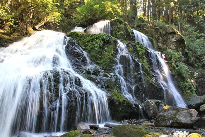
Rolley Falls
Take Bell Street north
of Dewdney Trunk Road.
Take the easy lakeside trail east to a wooden bridge. Don’t cross the bridge; walk straight ahead until the trail turns uphill to the right. Follow an undeveloped forest trail to the left for 15 minutes.
Moderate trails
Steelhead Mountain
Take Cardinal Street and turn
right on Johnston Street
Travel about 3 km and turn right on Campbell Street then stay left. Climb the ridge west (one hour) of Hatzic Valley and see six major peaks and the Fraser Valley.
Hayward Lake Reservoir Trail
Access from Stave Falls Dam
or Ruskin Dam at Wilson Street
The Hayward Reservoir Trail and Hayward Railway Trail combine to provide a complete loop around Hayward Lake. Enjoy old growth and second growth forests, bridged creeks and the Steelhead Falls viewpoint. The 18 km loop takes more than four hours to complete.
Bear Mountain
Starts at the end of Saunders Street,
just north of Richards Avenue
Follow a forestry road into the Mission Municipal Forest. Mountain bikes allowed.
Challenging trail
Mt. Crickmer
Access starts 7 km along Burma Road,
north of Dewdney Trunk
This is the highest summit in the municipal forest. There are views of Stave Lake, Alouette Lake, Mt. Blanshard and Golden Ears Park. The trail is 8.7 km (one way) and gains 1,156 metres in elevation.
Call the Visitor InfoCentre 604-826-6914
for more information