Planners hoping to develop Mission’s waterfront have often said it’s something that “no one landowner can do on their own.”
That sentiment also appears to be true for construction of the “superdike” meant to protect the area from a significant flood event.
Reports on the implementation strategy for Waterfront Revitalization Master Plan, and the current state of Mission’s dikes are set to come before council in February and March, respectively.
The implementation strategy has two paths forward, one with the city leading the way, and the other developer driven, according to Carla Guererra, CEO of Purpose Driven Development and Planning.
The former would require the city “to be a really active player in land acquisition and infrastructure building,” Guererra said to council last month.
And dike building is an incredibly expensive endeavor – building a superdike, even more so.
Unlike a regular dike which just serves as a barrier, a superdike raises the entire land mass to the flood construction level. Its width offers greater protection from earthquakes, and allows for development on top.
The cons, according to Floodwise BC, are a complex and expensive construction, along with ownership issues.
Unacceptable dikes:
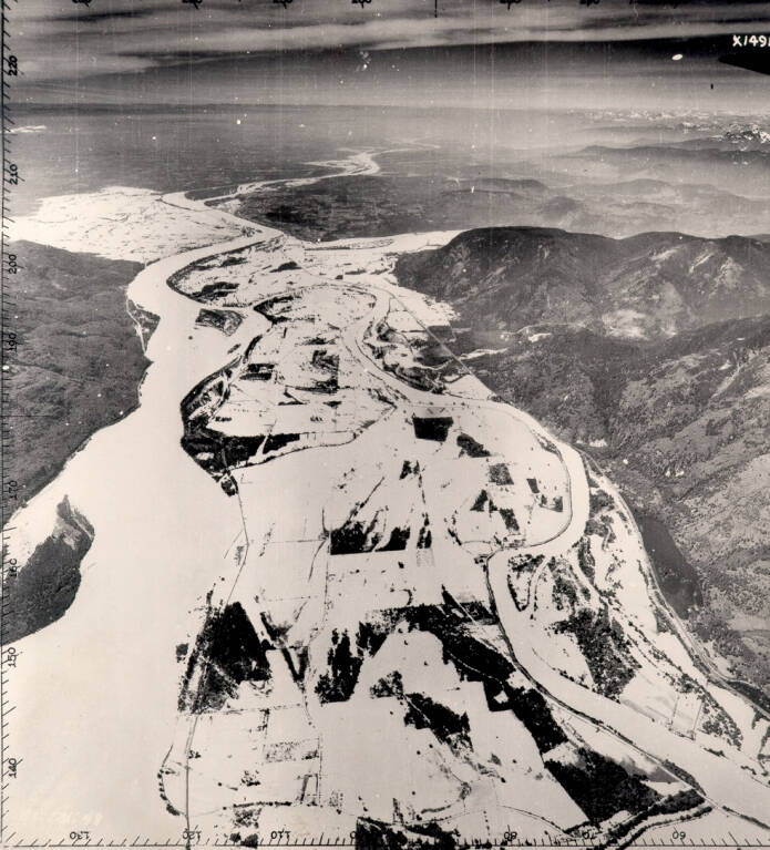
The height of Mission’s current dikes running for a kilometre along the eastern edge of the waterfront area received an “unacceptable” rating in the province’s 2015 Lower Mainland Dike Assessment.
The report found at its weakest, the dike was too low, needed design updates, minor stability issues could be expected in a major flood, it was seismically unstable and there was erosion.
That weak point is near Harbour Avenue’s intersection with Horne Street, where it only has a height of 7.2 metres above sea level, according to Tracy Kyle, Mission’s director of engineering and public works.
That’s over two metres below the 9.5-metre flood construction level needed to protect against a once-in-200-year flood.
“In front of the old Meeker Mill … There is no continuous dike structure and a large part of this area has to be temporarily diked during extreme freshets,” Kyle said, noting the temp dikes start to be installed when the Fraser reaches 6 metres.
“The last time this happened was June 2012 when the river reached 6.2 metres.”
The flood of record occurred in 1894 when the Fraser River reached nearly 8 metres. Flood construction levels are set in order to guard against a similar event.
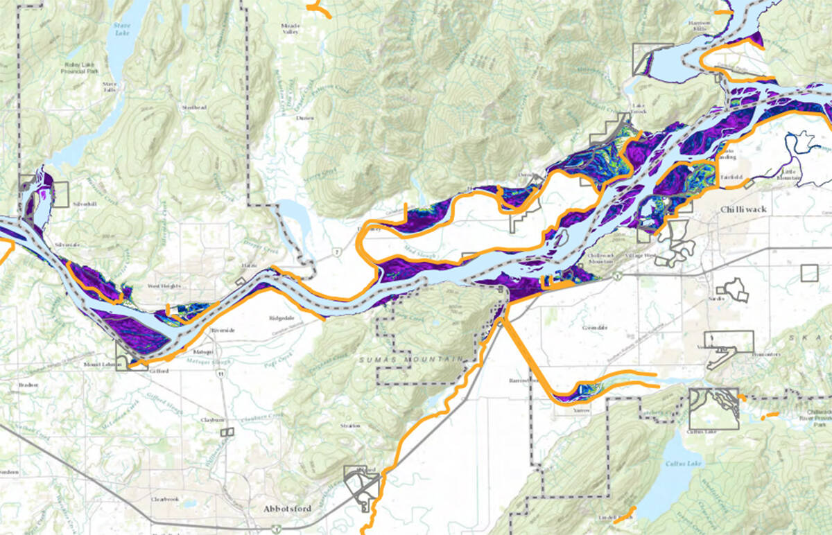
Modelling commissioned by the Fraser River Basin Council in 2019, predicted that most of the 297 acres in Mission’s designated waterfront planning area would flood if a once-in-a-100-year flood occurred.
In other words, they suggest a 1948-type flood (7.5 metres) would soak nearly 100 individual commercial and industrial properties concentrated east of the CPR bridge.
A repeat of 1894’s flood would submerge everything below Lougheed Highway.
Land assembly likely:
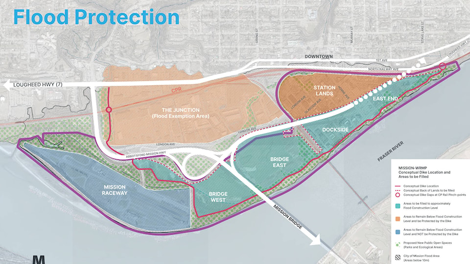
A city design map shows the superdike would raise all land south of Highway 11, and east from Mission Raceway Park to Lougheed Highway to the flood construction level.
The plan is to raise everything to 9.7 metres, giving the area a two-foot leeway over past flood events, said Gerald Schlesiger, project manager of the waterfront masterplan.
He said they’re still working out what that undertaking will cost, but a land assembly is “on the radar” due to the logistics of the many landowners in the eastern portion of the waterfront area.
“A lot of those properties are small, so it’s not going to be done on an individual basis, there’s going to be some sort of collaboration,” Schlesiger said. “Otherwise you’re waiting there for someone to actually buy the owners out.”
Planners are still working out the details, but are leaning towards a developer-driven implementation, he said. In that scenario, if a developer has acquired five acres and wants to develop, they would be responsible for raising the land.
“You want to develop that five acres, we want the dike along the river,” Schlesiger said.
Just under 600,000 cubic metres of sand is currently being dredged out of the Fraser River for the construction of the sewer force main project. That sand is being used to raise the dikes on the Braich property.
“They’re going to be pretty well set to go if they meet the flood protection level. It gives them a definite advantage of where development might happen first,” Schlesiger said.