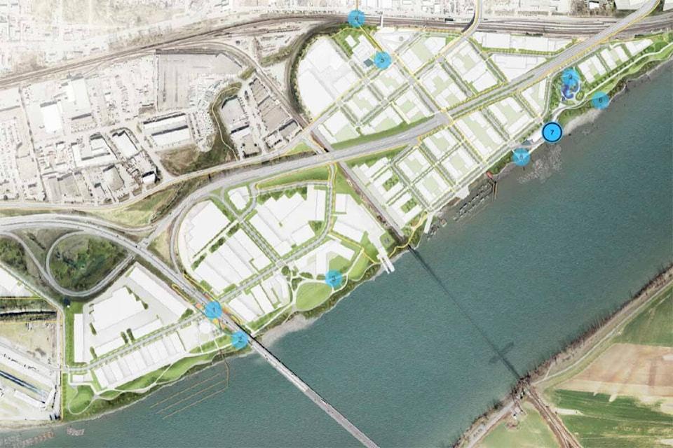
An interactive map detailing what planners are currently envisioning for the waterfront has been released by the City of Mission.
The map has nine components, complete with concept art to paint a picture of what the future of the 296-acre area may look like once it is fully developed.
The areas include an underpass park with multiple sports courts and pathways below the Mission Bridge, greenspaces, two urban plazas, a terrace, a playground and a beach.
The map was released alongside a new draft of the land use plan, creating for the Waterfront Revitalization Master Plan. The new draft has drawn on community input received in the first two phases of the project.
“Our planning has demonstrated that a made-in-Mission waterfront is realistic,” said Mayor Paul Horn. “Council’s enthusiasm for this project is grounded in how it will create jobs, improve transportation, embrace nature and provide public access. Now we need to hear what our community thinks before we consider implementation.”
The map aims to gather more input from the community on what they like, and what they feel is still missing, according to a press release from the city.
The feedback will inform the final draft before it comes before council this Spring.
This final engagement stage also includes another public survey available until April 5, and an open house at the Mission Leisure Centre on March 30.
When the masterplan is complete, council will vote to incorporate it into the Official Community Plan. A final public hearing will be held on June 20.
RELATED: Mission council endorses land-use plan for waterfront development
@portmoodypigeon
patrick.penner@missioncityrecord.com
Like us on Facebook and follow us on Twitter.