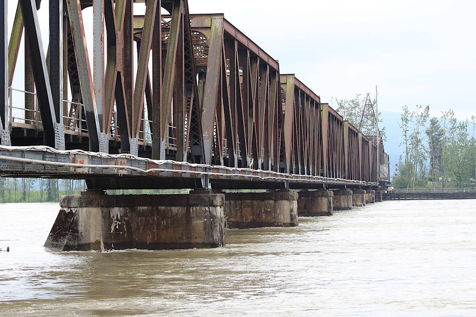
While district staff continue to keep a close eye on the water level by the Mission train bridge, it appears that a major flood is not in Mission’s immediate future.
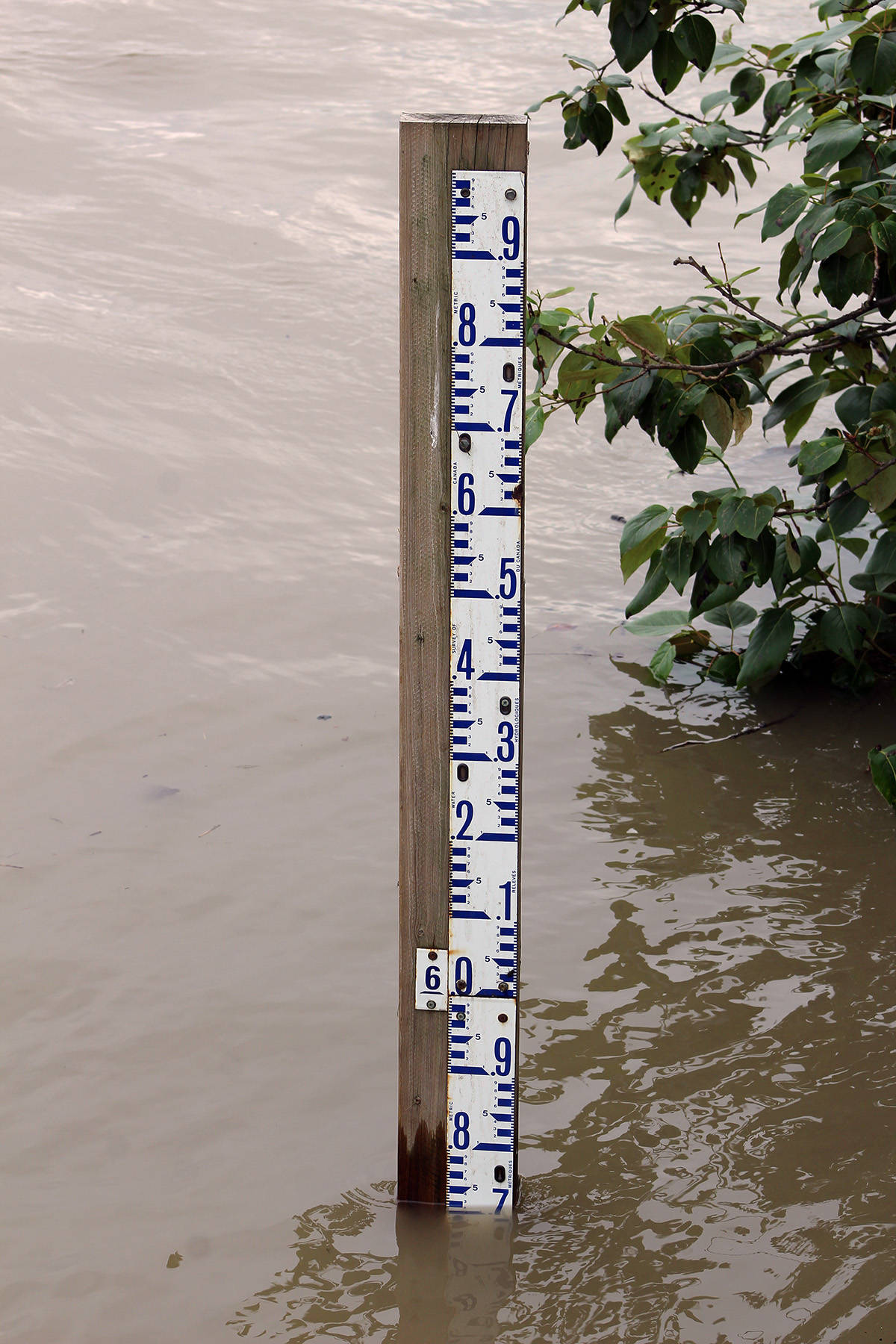
As of Thursday morning, the Mission gauge had the Fraser River water level at 5.8 metres and projections are that it will peak at about 6.7 metres sometime next week.
“Based on the model projection of 6.7 metres at Mission, at the CPR bridge, we are not expecting any widespread flooding. We are expecting that areas outside the dike will be subjected to some water,” said Mike Younie, Mission’s deputy chief administrative officer.
Younie said areas outside of the dike are starting to see some seepage and some wet ground right now.
“If you are inside the dike, inside the dike in Mission is different than inside the dike in Silverdale because that is an agricultural dike and doesn’t offer the same protection.”
Areas that may be at some risk include parts of Ruskin and Silvermere.
“We don’t believe they are at risk at the current predictions of the models we’ve been given. I think they are going to want to keep an eye on their crawlspaces if they have them and basements or things like that. I don’t see water coming into people’s homes over there,” Younie said.
He also believes a number of businesses at the bottom of Nelson Avenue could see some flooding in their yards.
The Mission dike is built to a minimum of 8.5 metres elevation, with a gap that gets filled on a temporary basis at the foot of Horne Street.
That area normally floods at about 6.7 metres, which Younie says is where the water level is estimated to be by next week. Crews will likely fill that gap this weekend.
Younie explained that when the original dike was built, there was a mill at that location. When the mill burned down, the dike was never upgraded at that spot.
Instead, if needed, a temporary dike is created using gabions (wire-mesh sections of sandbags filled with sand and stacked on top of each other).
Younie said in the past 10 years they have only had to build the temporary dike twice.
“And we will have to build it again this year.”
While his best guess is that there will not be any major flooding, Younie said things can change.
“What could really hurt us now is rain,” he said, adding a close eye has to be kept on the water level.
“People need to be prepared. They need to have a plan. They need to stay away from the river and fast-flowing water.”
“People should look at the river from a distance. Don’t go in it, don’t try to take a small boat in it and be very, very cautious.”
Evacuation order:
An evacuation order was issued this week to five properties at Harrison Bay in Electoral Area C.
The Fraser Valley Regional District issued the order on Wednesday (May 16). Members of the RCMP assisted in the delivery of this order, which is limited to five properties at this time. An emergency reception centre has been established in Mission at Fire Hall No. 1, 33330 Seventh Ave.
Electoral Area C includes Hemlock Valley, Harrison Mills, Lake Errock, and several First Nations, including Douglas, Leq’a:mel, Samahquam, Scowlitz, Skatin and Sts’ailes.